v3389-1196
----- Ridge
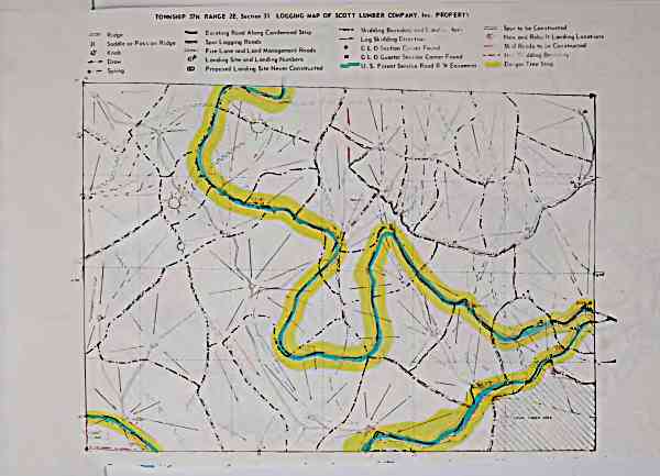
TOWNSHIP 37N RANGE 2E, Sec.lon 31 LOGGING MAP OF SCOTT LUMBER COMPANY. Inc. PROPERTY
"= Etmg Rood Along Condemned Strip
- Skidding Boundary end Land: . Ai
)( SoddleorPossonR.dge = Spur Logging Roods ^ Log Skidding Duection
^ l^, =---.^-- Fire Lone ond Lond Monogement Roods
^..^ Draw ^ Landing Site ond Londing Numbers
. Spring
(D Proposed Londing Site Never Constructed
== Spur to be Constructed
Nev, and Rebu-lt Landing Locations
C L Section C;,ner Found Sk .d Roods to '.,e Constructed
G L Quarter Sec, on Corner Found ' " dding Br-.md. ry
^^U. S. Forest Service Rood R Vl Easement Danger Tree Strip
archive.org Volume Name: govuscourtsca9briefs3389
Volume: http://archive.org/stream/govuscourtsca9briefs3389
Document Link: http://archive.org/stream/govuscourtsca9briefs3389#page/n1195/mode/1up
Top Keywords (auto-generated):
roods, constructed, strip, spur, skidding, site, rood, ond, londing, logging, landing, vl, tree, township, tmg
Top Key Phrases (auto-generated):
vl easement, tree strip, township 37n, tmg rood, strip skidding, strip , spur logging, skidding duection, skidding boundary, site ond, scott lumber, roods log, rood along, ridge township, ridge
Document Status: UGLY